Colorado 7/2006

Well, just got back from a nine day trip to Colorado and back.  The place has left me speechless and yearning to go back.

My oldest daughter has decided to settle, at least temporarily, in Crestone Colorado.  So, after her coming here to visit several times and bugging me every time, I decided it was time to pay her a visit.

At first I thought about riding my motorcycle out there but my other daughter also wanted to go, as well as my sister, so the bike wasn't going unless I wanted to tow it out there on my rickety trailer.  The decision was made for me when we realized that we needed to take my sisters car because it had more rear leg room and a bigger trunk, which we completely stuffed.

Well, we took off 8:00 am, Saturday, July 15th.  Sad to say there isn't much to see until you get near Denver.  Lots of corn fields and cows, and that's about it.  Usually you could smell the cows a mile or two before you get to them.  Western Nebraska and North Eastern Colorado is a little different in that most of what we saw was bordering on desert, but occasionally you get to a huge green field.  The farmers have theses big moving sprinklers that drench the crops and make it possible for them to grow.  It's such a contrast, usually on one side of the highway you have the near desolate field and on the other a rich green field of corn or other crop.

We spend some time wondering why the US grows so much corn.  What about all the other vegetables?  We came to the conclusion that other vegetables are labor intensive and California is the only place where there is sufficient low wage labor to make it feasible.  Also, corn can be stored.  It all comes down to money; regardless of the fact that all Americans could probably do with a lot less corn and a lot more other vegetables. 

Anyway, economics and diet aside... There were two noteworthy points to the trip while going through Iowa and Nebraska.  In Iowa we crossed the Mississippi river, and in Nebraska we almost got eaten by mosquitoes.  At the rest stop that we chose to stop for lunch we were quickly chased out.  Soon as we got to the tables and benches where we would eat, the mosquitoes absolutely swarmed.  I was the last to get there from the car so by the time I did get there the girls had already been bitten up and turned around.  It's all we could do to get out of there fast enough, and so we ate our lunch in the car while driving.

We took a lot of pictures when passing through Denver, when we first saw the mountains.  At the time it was the best view we had ever seen, but of course it just kept getting better and better.  On our trip back I missed taking pictures of one of the nicest roads I'd ever seen because I had run out of film; eight rolls wasn't enough.

These two photos were taken as we crossed the Mississippi.


Here is a shot as we got to Denver.  You can barely see the hazy outline of the mountains.  The sandy field in front is pretty much what we saw in Western Nebraska.


We finally started getting closer and the scenery started improving:


The roads through the mountains are beautiful.  The rock formations are similar to the photo above, but typically on both sides of the road, very curvy and climbing higher and higher.  But when you come up over the other side the road opens up into a huge valley.  It's such a contrast, not to be able to see around the next curve and then all of a sudden you see for miles.  Sorry to say these pictures just don't do it justice.  You would need a panoramic camera that has five times the field of view of a normal camera to really capture the scale.


After this expansive valley we then went back into the mountains for a final climb and descent into the San Luis Valley, where Crestone is situated at the base of the Sangre de Cristo Mountains.  The San Luis Valley is the largest high altitude Alpine Valley in the world.  In the West is the La Garita Range of the San Juan Mountains.  The stretch between them is at least 60 miles and you can see it all.  The length of the valley I'm not even sure about, but it is basically flat and desert.

This is a shot while approaching Crestone down Colorado road T.


Well, after two days and 20 hours on the road we finally arrived.  From that point the trip just kept getting better.

First day my daughter and her boyfriend took us for a hike in the mountains.  That was definitely a challenge.  None of us had seen mountains this big, let alone gone hiking on them, and starting at an altitude of 9000 ft the air was a little thinner than we were use to.  My sister didn't think she could last more than 20 minutes, but it's funny what the human body can do.  When we got tired we stopped to rest, and soon we were at our destination.  Both of my younger daughters had a meltdown on the way up.  One all of a sudden one was afraid of heights and the other just felt she couldn't do it physically.  But, we got through those moments and they are both better for the experience.  Here is a series of chronological shots which shows the progression up the mountain.  We wanted to go even further, but the youngest daughter had had enough and we didn't want to push it.  So we never made our final destination which was a waterfall.


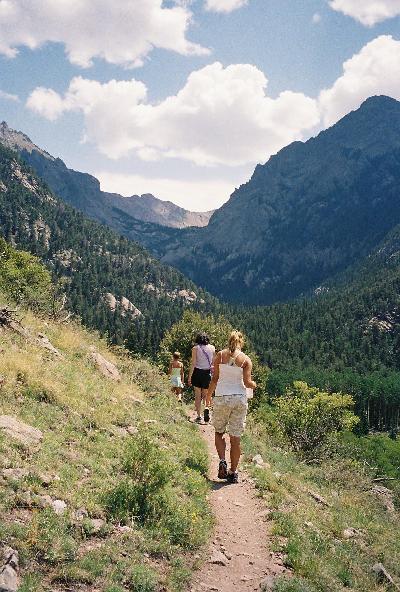
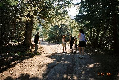
The start of the trail.  Actually, this is part of the read leading to the
start of the trail, but our cars couldn't make it, so we had to hike to
the start of the trail.

One of the much needed rest stops.  The trail actually is a series of
switchbacks so that you're walking up and across the mountain.
Going straight up would be very difficult if not impossible.

This is actually pretty funny.  My daughters dog found some kind of hole
and started digging into it.  At one point her whole head was in it up to
her front legs.


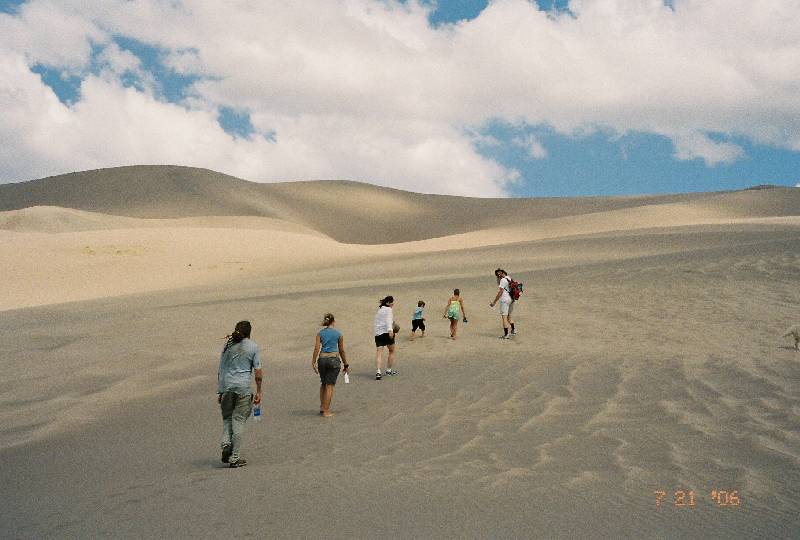
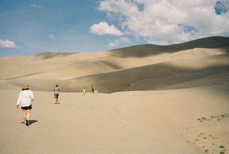
The photos below are from the valley which we reached at the end
of our hike.  I will let them speak for themselves (beautiful comes to
mind):


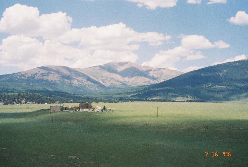
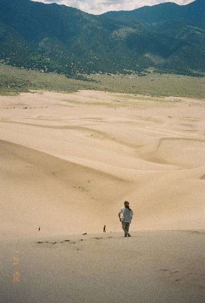
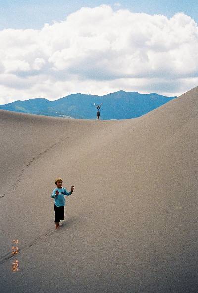
You can't really make it out, but in the distance is the San Luis valley.


And this has to be one of my favorite shots.  I took it when my oldest daughter, her boyfriend and I went down into the valley to replenish our water supply (yes, you go through a lot of water).  At one point we walked in that stream, and it had to be 35 degrees.  Stepping into it was a total shock, and standing in it your feet quickly start getting numb.  You can't really tell on the picture, but the water is very clean.  All you see is the rocks on the bottom.


It was at this point in our trip that we decided to continue to the source of the stream and the water fall.  We hiked for a mile or so further, but when we realized it was even further than we'd thought, we turned around.  Three hours hiking up the mountain was more than enough for the first day.

Day Two

After all the hiking on day one I though I'd be really sore on day two.  I did feel it, and I felt it more as the day went on, but it wasn't anywhere as bad as I though.  I felt it in my calves and my left knee had a small kink in it.  But I was feeling good over all.

So, what better way to loose the minor aches from hiking but to go to a natural hotsprings.  I guess the water comes out of the ground at 160 degrees and they cool it off into three different pools at different temperatures.  The coolest was about 98 and the warmest was about 105.  Doesn't sound like much of a difference, but you can sure feel it. 

Here's some shots from the hotsprings.  In the first shot you can see the sky in the background (the blue; the white is just a covering they have over each pool.  There's a big deck area and the little Christmas lights are all around, so it's really gentle lighting.


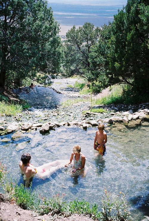
This was the medium temperature of the three pools, it's also the deepest.  My daughter there is standing up, so it's about 5 feet deep.


Day 3

Well, day three was relatively toned down.  Only thing we did was go to a local stream / swimming hole.  Everyone but myself walked the stream, and my daughters had a blast shooting through a tube which routs the stream under the road.  So, they would climb up the tube and then come shooting out.

We ran into a guy there who was actually from our area.  He bought some land at auction for $1200, sight unseen, and it turned out to be in the valley but backing up into a greenbelt (strips of green vegetation and trees the run along the streams that come out of the mountains and wash down into the valley.  Now he was building a house on it and figures he'll be coming out here to visit and maybe rent it out in the mean time.

Day 4

Well, I figured day four was going to be a sit around do nothing day because my sister and daughter wanted to go to a clothing optional hotsprings up in the mountains.  I wasn't too keen on the idea of my younger daughters seeing fully grown men walking around naked.  That was just a bit too much education.  But in the end I figured why not.  Safe to say it was an absolutely great time.

First thing is they have this huge pool.  It's kind of strange because the pool is dark green on the sides; almost black.  But that's from the algae.  There's no chlorine.  Just fresh hotspring water running down the mountain and going in and out of the pool.  By the time it makes it's way down the mountain to this lowest pool it is 89 degrees.  I swam, dove off the board with the kids, did cannonballs.  It was a total blast.  Here's my youngest doing a cartwheel into the water:


And yes, there were naked people.  I though it was kind of funny.  There was this guy, with his trunks on, sitting in a chair, playing the guitar.  My sister was in the shallow water next to him and they started talking.  As they were talking, this guy just gets up like no one's business, drops his trunks and gets in the pool. Never missed a beat.  I think he was just advertising.

After staying there for a while we then hiked up the mountain to the source of the stream which feeds the pool.  This was no small hike, and the trail was quite steep at some points.  The first pool wasn't too far up, but we continued.

Another interesting naked experience.  So we're going up the mountain, and this couple is coming down.  The woman is topless, and well endowed.  We were sitting resting and they just strike up a conversation with us, just like we were all in their bedroom... not out in the open on the side of a mountain talking to a half naked stranger. 

Anyway, we made it to the top, and here is a shot from above the pools as they go down the mountain.  There are actually three right in a row here:


The actual source of the water is just to the right in the above picture in a tiny cave.  Also, it seems like the water must be coming up through the ground, because you can see small bubbles coming up.  They feel like you're standing in soda pop.  Not as many of them, but the same effect.  Also, the spring pools are not very deep, but that's a good thing, because they are too hot to really submerge yourself for any length of time.

Well, we hiked back down the mountain, spent more time in the big pool, and then called it a day. 

Day 5

If you think it's been good up to now...

We got an early start because today we were going to walk the dunes.  Yup, less than an hour from these hot springs and evergreen mountains, we have total desolation.  In fact we were told that these were the dunes at which the Star Wars movie was filmed.  But, even before that, 20 minutes drive from there is a water fall.

You can't see the waterfall from anywhere along the stream that it generates.  You have to actually walk the stream... again, very cold water, to get to the source.  So, that's what we did, we took our shoes off and walked through the stream and rocks.


At the top left hand corner, the dark cave is basically where you can't go any further without taking your shoes off; assuming you don't want to get them wet.  That's not really a cave, it's just two rock cliffs where the water must have worn down the rock over the years.

This is a photo looking down stream from that cavelike area.

This is an image standing at the mouth of the cave looking up.

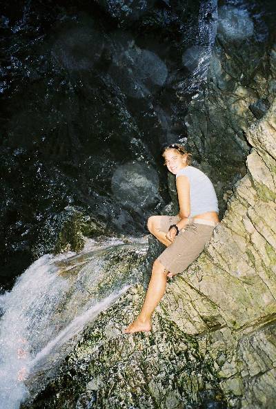
This is at the back of the cave just below the photo to the left.

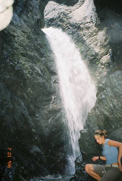
And this is at the very back of that cave area.


Now that our feet were all chilly and we were refreshed, we hiked back down to our cars and drove the 20 minutes to the dunes.  They look so small in the distance and keep getting bigger and bigger as you get closer.  We got lucky with the fact that it had rained recently, so when we got on the dunes the sand stuck together fairly well in most places.  That made the climb easier.  It was good that there were some clouds which gave some shade.  It was definitely the hardest hiking we'd done all week, like everything else was just conditioning for this.  So, we picked the highest peek and climbed our way to it.  Of course the pictures just don't do it justice.  This particular one is when were were getting toward the top.  The closer we got to the top the more windy it got.  At the top it was like getting sand blasted.


This is about 1/4 of the way up.


This is a shot from the peak looking down into one of the bowls that we ran down into.  Actually my daughters boyfriend rolled all the way down.

And this is a photo from inside that bowl.

Even the trip back had it's moments.  We decided to take route 50 rather than the way we came.  I had used up all eight rolls of film, and I probably should have bought more, because that road was beautiful.  For the most part it ran along the Arkansas river.  Huge rock cliffs on one side, and the river on the other side, with people tubing, fishing, going down rapids, and just mile after mile of curvy road.  Here's a map shot of the road.  Notice how squigglie it is...


I think I need to buy some property out there somewhere...